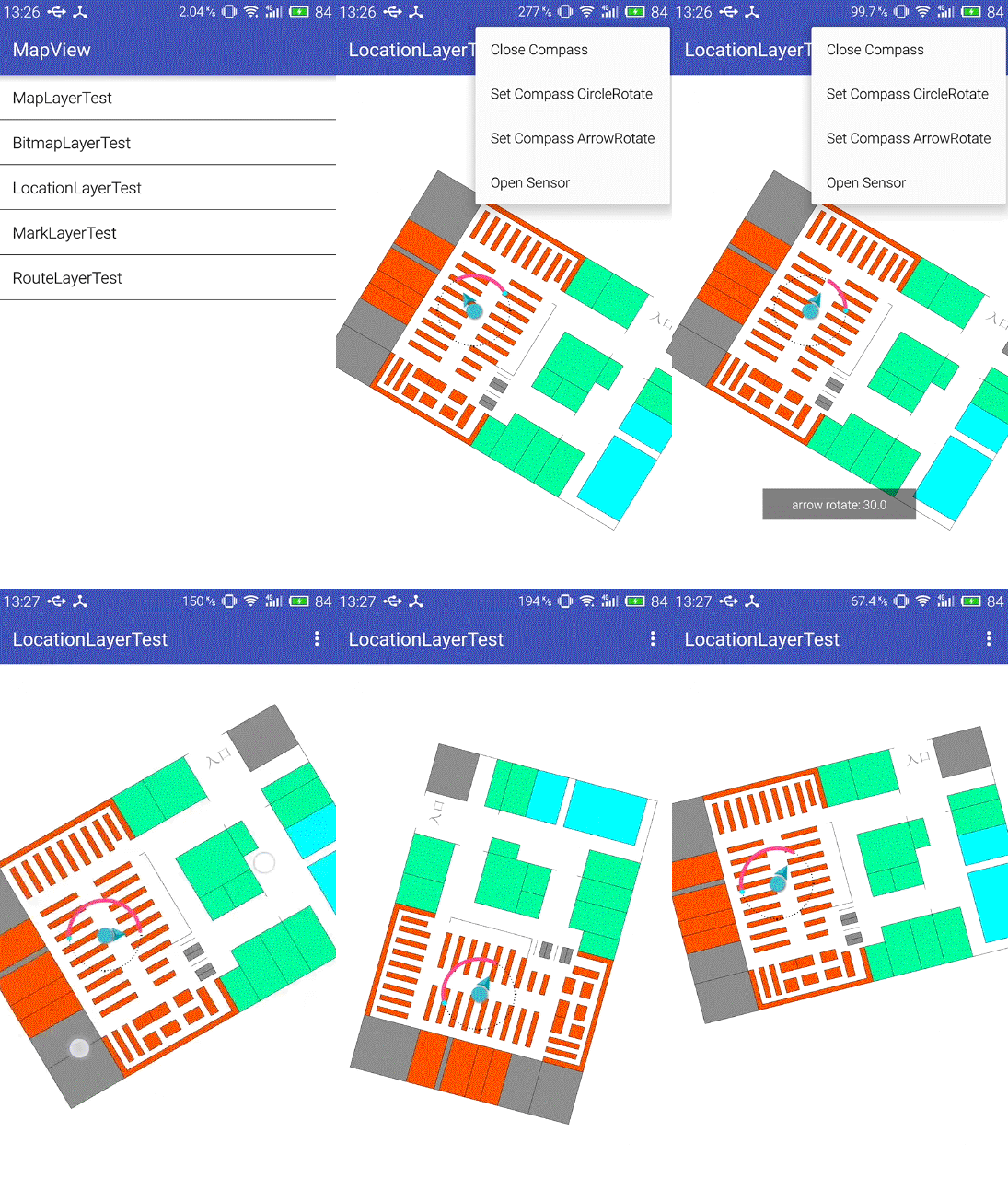
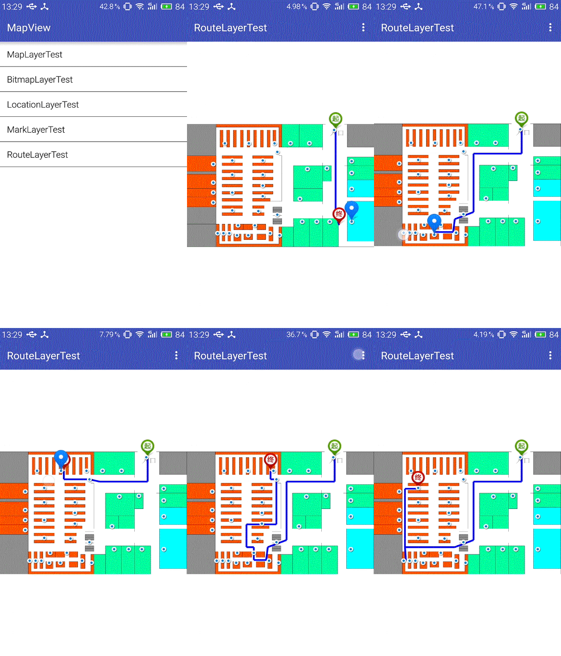
This is a wrap for this github project.
IndoorMaps
Author: DonManfred (wrapper)
Version: 1
The Data which will be get with the Testdata helper are for the sample map the lib provided.
You need to generate you own data for your own maps.


IndoorMaps
Author: DonManfred (wrapper)
Version: 1
- BitmapLayer
Methods:- Initialize (EventName As String, mapView As MapView, bitmap As Bitmap, location As PointF)
- IsInitialized As Boolean
- isAutoScale As Boolean
- AutoScale As Boolean [write only]
- Bitmap As Bitmap
- Level As Int [write only]
- Location As PointF
- IndoorMap
Events:- onMapLoaded (success As Boolean)
- ba As BA
- BringToFront
- DesignerCreateView (base As PanelWrapper, lw As LabelWrapper, props As Map)
- Initialize (EventName As String)
- Invalidate
- Invalidate2 (arg0 As Rect)
- Invalidate3 (arg0 As Int, arg1 As Int, arg2 As Int, arg3 As Int)
- IsInitialized As Boolean
- RemoveView
- RequestFocus As Boolean
- SendToBack
- SetBackgroundImage (arg0 As Bitmap)
- SetColorAnimated (arg0 As Int, arg1 As Int, arg2 As Int)
- SetLayout (arg0 As Int, arg1 As Int, arg2 As Int, arg3 As Int)
- SetLayoutAnimated (arg0 As Int, arg1 As Int, arg2 As Int, arg3 As Int, arg4 As Int)
- SetVisibleAnimated (arg0 As Int, arg1 As Boolean)
- addLayer (layer As MapBaseLayer)
add layer
layer: - convertMapXYToScreenXY (x As Float, y As Float) As Float[]
convert coordinate of map to coordinate of screen
x:
y:
Return type: @return: - isMapLoadFinish As Boolean
map is/not load finish
Return type: @return: - isScaleAndRotateTogether As Boolean
- loadMap (bitmap As Bitmap)
- mapCenterWithPoint (x As Float, y As Float)
set point to map center
x:
y: - refresh
reload mapview - setCurrentRotateDegrees2 (degrees As Float, x As Float, y As Float)
set rotate degrees
degrees:
x:
y: - setCurrentZoom2 (zoom As Float, x As Float, y As Float)
- translate (x As Float, y As Float)
- withFloorPlan (x As Float, y As Float) As Boolean
point is/not in floor plan
x:
y:
Return type: @return:
- Background As Drawable
- Color As Int [write only]
- CurrentRotateDegrees As Float
set rotate degrees - CurrentZoom As Float
- Enabled As Boolean
- Height As Int
- Layers As List [read only]
get all layers - Left As Int
- MapHeight As Float [read only]
- MapWidth As Float [read only]
- MaxZoom As Float [write only]
- MinZoom As Float [write only]
- Parent As Object [read only]
- ScaleAndRotateTogether As Boolean [write only]
setting scale&rotate is/not together on touch - Tag As Object
- Top As Int
- Visible As Boolean
- Width As Int
- LocationLayer
Methods:- Initialize (EventName As String, mapView As MapView, currentPosition As PointF, openCompass As Boolean)
- IsInitialized As Boolean
- isOpenCompass As Boolean
- CompassIndicatorArrowRotateDegree As Float
- CompassIndicatorCircleRotateDegree As Float
- CurrentPosition As PointF
- Level As Int [write only]
- OpenCompass As Boolean [write only]
- MapLayer
Methods:- Initialize (EventName As String, mapView As MapView)
- IsInitialized As Boolean
- Image As Picture
- Level As Int [write only]
- MapUtils
Methods:- Initialize (nodessize As Int, nodescontactsize As Int)
- IsInitialized As Boolean
- getBestPathBetweenPoints (points() As Int, nodes As List, nodesContact As List) As List
get best path between points
points:
nodes:
nodesContact:
Return type: @return: - getDegreeBetweenTwoPointsWithHorizontal (routeList As List, nodes As List) As List
get degrees between two points(list) with horizontal plane
routeList:
nodes:
Return type: @return: - getDegreeBetweenTwoPointsWithVertical (routeList As List, nodes As List) As List
get degrees between two points(list) with vertical plane
routeList:
nodes:
Return type: @return: - getDistanceBetweenList (nodes As List, list As List) As Float
Get the distance between points
nodes:
list:
Return type: @return: - getMatrixBetweenFloorPlanNodes (nodes As List, nodesContact As List) As Float[][]
adjacency matrix with points
nodes:
nodesContact:
Return type: @return: - getShortestDistanceBetweenTwoPoints (start As Int, end As Int, nodes As List, nodesContact As List) As Float
get shortest distance between two points
start:
end:
nodes:
nodesContact:
Return type: @return: - getShortestPathBetweenTwoPoints (start As Int, end As Int, nodes As List, nodesContact As List) As List
get shortest path between two points
start: start point
end: end point
nodes: nodes list
nodesContact: nodesContact list
Return type: @return:
- MarkLayer
Events:- Clicked (index As Int)
- Initialize (EventName As String, mapView As MapView, marks As List, marksName As List)
- IsInitialized As Boolean
- isClickMark As Boolean
- Level As Int [write only]
- Marks As List
- MarksName As List
- Num As Int
- PointF
Methods:- Initialize (x As Float, y As Float)
- IsInitialized As Boolean
- equals (c As Object) As Boolean
- negate
- setOffset (dx As Float, dy As Float)
- setPosition (x As Float, y As Float)
- setlength (x As Float, y As Float)
- toString As String
- length As Void [read only]
- RouteLayer
Methods:- Initialize (EventName As String, mapView As MapView, nodeList As List, routeList As List)
- IsInitialized As Boolean
- Level As Int [write only]
- NodeList As List [write only]
- RouteList As List [write only]
- Testdata
Properties:- Marks As List [read only]
- MarksName As List [read only]
- NodesContactList As List [read only]
- NodesList As List [read only]
The Data which will be get with the Testdata helper are for the sample map the lib provided.
You need to generate you own data for your own maps.


