It has been too long since I've scaled values. Anyone want to help me?
B4X:
I have a frame area :

y1 +------------------------------------------------------------------+
   |                                                                  |
   |                                                                  |
   |                                                                  |
   |                                                                  |
   |                                                                  |
   |                                                                  |
   |                                                                  |
   |                                                                  |
   |                                                                  |
   |                                                                  |
   |                                                                  |
   |                                                                  |
   |                                                                  |
   |                                                                  |
   |                                                                  |
   |                                                                  |
   |                                                                  |
   |                                                                  |
y2 +------------------------------------------------------------------+
   x1                                                                 x2

X1 = 40
x2 = 525
widthX = x2 - x1 = 485

y1 = 50
y2 = 220
heightY = y2 - y1 = 170

I need to scale points to the frame:

pointsMinX = 3000
pointsMaxX = 4200

pointsMinY = 5000
pointsMaxY = 6400

Example point to scale to frame:

PointX = 3200
PointY = 5450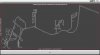
")
